IBCAO V5 Release Paper

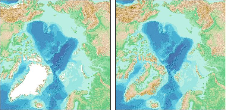
Shaded relief imagery for the Arctic Ocean area, based on the IBCAO V5; with (left) and without (right) ice surface elevation information for the Greenland Ice Sheet.
The goal of the International Bathymetric Chart of the Arctic Ocean (IBCAO) is to develop a digital data base that contains all available bathymetric data north of 64° North, for use by mapmakers, researchers, institutions, and others whose work requires a detailed and accurate knowledge of the depth and the shape of the Arctic seabed.
Access the release paper for Version 5 of the IBCAO to find out more about the development of the data set. Jakobsson, M., Mohammad, R., Karlsson, M. et al. The International Bathymetric Chart of the Arctic Ocean Version 5.0. Sci Data 11, 1420 (2024). https://doi.org/10.1038/s41597-024-04278-w.
The IBCAO data sets are available to download and are included, as a regional compilation, in the global GEBCO grid.
Imagery based on the IBCAO grids is available as a Web Map Service (WMS).
Find out more about the IBCAO.
Back for more news and events items.


