
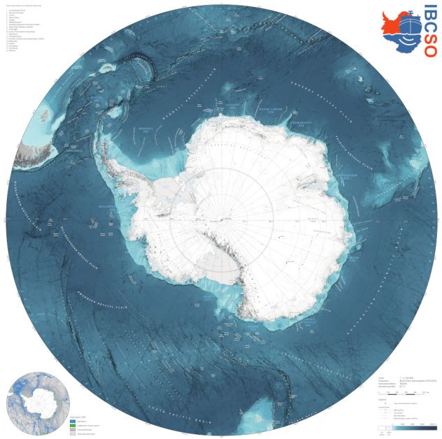
The IBCSO is the authoritative map of the Southern Ocean. It is based on billions of soundings contributed by organisations across the globe.
IBCSO 2024 Annual Release
The IBCSO 2024 Annual Release was published in November 2024 - this is an update to Version 2 of the IBCSO Grid. The data set can be accessed from the IBCSO web site.
Version 2 of the IBCSO
Version 2 of the IBCSO Grid was released in 2022 and is available to download from PANGAEA's web site. It has a resolution of 500 m × 500 m in a Polar Stereographic projection (EPSG: 9354). The total data coverage of the seafloor is 23.79% with a multibeam-only data coverage of 22.32%. The remaining 1.47% include singlebeam and other data. IBCSO v2 is the most authoritative seafloor map of the area south of 50°S.
Find out more from the release paper: Dorschel, B., Hehemann, L., Viquerat, S. et al. The International Bathymetric Chart of the Southern Ocean Version 2. Sci Data 9, 275 (2022). https://doi.org/10.1038/s41597-022-01366-7.
The Alfred Wegener Institute chairs the IBCSO and, in addition, is the Southern Ocean Regional Center for the Nippon Foundation-GEBCO Seabed 2030 Project.
Find out more about the IBCSO.