New version of the GEBCO global bathymetric grid

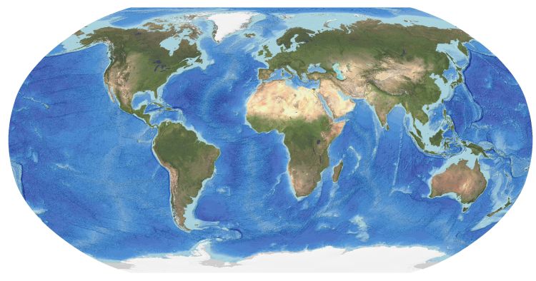
The GEBCO_2022 Grid is a global terrain model for oceans and land providing elevation data, in meters, on a 15 arc-second interval grid.
It is the fourth GEBCO grid developed through the Nippon Foundation-GEBCO Seabed 2030 Project.This is a collaborative project between the Nippon Foundation of Japan and GEBCO. The aim of the project is to map the global sea floor by 2030.
For the 2022 release of the GEBCO grid, it is estimated that 23.4% of seafloor has now been mapped, this is an increase from 20.6% for the previous release, GEBCO_2021.
Find out more about the compilation of the data set.
GEBCO's grids can be downloaded as a global file in netCDF format or for user-defined areas, through our download app, in netCDF, data GeoTiff and ESRI ASCII raster formats.
Please note that previous releases of GEBCO grid can also be accessed through the app.
Find out how to contribute bathymetric data sets to help update the global GEBCO grid.
GEBCO's aim is to provide the most authoritative publicly-available bathymetry of the world's oceans. It operates under the joint auspices of the International Hydrographic Organization (IHO) and the Intergovernmental Oceanographic Commission (IOC) (of UNESCO).
Find out more about GEBCO's work and data sets.
Back for more news and events items.


