Imagery from the IBCM products is available in GeoTiff or JPEG format on request from the Nippon Foundation-GEBCO Seabed 2030 Global Center:

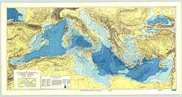
This bathymetric chart is published by the Charts Division of the Head Department of Navigation and Oceanography in Russia under the authority of the Intergovernmental Oceanographic Commission (IOC) of UNESCO.
Originally compiled from ninety 1:250,000 scale British Admiralty Mercator plotting sheets for oceanic soundings, it presents the bathymetry and land topography as 200 m contours with supplemental 20 m, 50 m, and 100 m contours at sea.
Several versions are available; a 10 sheet set (each 74 X 90 cm) at 1:1,000,000 scale at 38 degrees N, and a photo-reduction to 1:5,000,000 scale. This chart, with an inset of the entire Black Sea at half scale, is also the basemap for a Geological/Geophysical series with Bouguer gravity anomalies (IBCM-G), seismicity (IBCM-S), thickness of Plio-Quaternary sediments (IBCM-PQ), unconsolidated bottom surface sediments (IBCM-SED), and magnetic anomalies (IBCM-M). Digital variants and explanatory brochures for these series are in preparation.
Imagery from the IBCM products is available in GeoTiff or JPEG format on request from the Nippon Foundation-GEBCO Seabed 2030 Global Center:

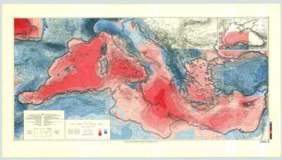
This Bouguer gravity anomaly map was compiled by Jannis Makris of the Institut fur Geophysik in Hamburg, and Carlo Morelli of the Istituto di Miniere e Geofisica Applicata in Triesete. It is published by the Charts Division of the Head Department of Navigation and Oceanography in Russia under the authority of the Intergovernmental Oceanographic Commission (IOC) of UNESCO.
The primary data are from over 114,000 nm of marine survey carried out in 1965-1972 by OGS in Trieste, and in 1973-1974 by the Dept. of Geodesy and Geophysics of Cambridge University, together with land compilations. It presents the anomalies in milligals, based upon the 1967 normal gravity formula, a 2.67 g/cm3 Bouguer density, and topographic corrections to 167 km for the land area in the easternmost four sheets.
Contours are every 10 mGal with changes in tint every 50 mGal. Red tints are positive. The bathymetry is from the 200 m contours of the original IBCM with supplemental 20 m, 50 m, and 100 m contours at sea. Two versions are available; a 10 sheet set (each 74 X 90 cm) at 1:1,000,000 scale at 38 degrees N, and a photo-reduction to 1:5,000,000 scale.
Imagery from the IBCM products is available in GeoTiff or JPEG format on request from the Nippon Foundation-GEBCO Seabed 2030 Global Center:

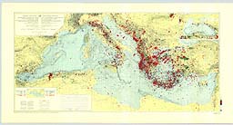
This Mediterranean seismicity map was compiled by Yvette Legros and Jean Bonnin under the scientific co-ordination of Jean Bonnin of the European-Mediterranean Seismological Centre (EMSC) in Strasbourg, France. It is published by the Charts Division of the Head Department of Navigation and Oceanography in Russia under the authority of the Intergovernmental Oceanographic Commission (IOC) of UNESCO.
Some 33,000 separate seismic earthquake epicenters in the Mediterranean region were recalculated and are plotted as colored symbols, with shape denoting depth of focus, size reflecting magnitude, and color (blue, green, red) showing the historical catalog (1904-1963; 1964-1975; 1976-1988) from which the events are taken. Explanations are in English and French.
The bathymetry is from 200 m contours of the original IBCM with supplemental 20 m, 50 m, and 100 m contours at sea. Two versions are available; a 10 sheet set (each 74 X 90 cm) at 1:1,000,000 scale at 38 degrees N, and a photo-reduction to 1:5,000,000 scale.
Imagery from the IBCM products is available in GeoTiff or JPEG format on request from the Nippon Foundation-GEBCO Seabed 2030 Global Center:

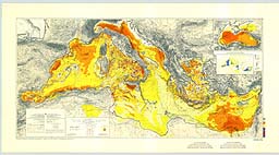
This Plio-Quaternary sediment thickness map was compiled under the direction of P. Burollet, M. Gennesseaux, P. Kuprin, E. Tzotzolakis, and E. Winnock. It is published by the Charts Division of the Head Department of Navigation and Oceanography in Russia under the authority of the Intergovernmental Oceanographic Commission (IOC) of UNESCO.
The primary data derive from numerous marine seismic surveys of the depth to the top of the Messinian salt layer, together with land compilations. Contours are in increments of 0.2 sec two-way travel time, with changes in tint at 0.2, 1.0, 2.0, and >30 sec. The bathymetry is from 200 m contours of the original IBCM with supplemental 20 m, 50 m, and 100 m contours at sea.
Explanations are in English and French, and tectonic, diapiric, and volcanic features are indicated. Inset is a sketch map showing the Messinian evaporite deposits in the Mediterranean. Two versions are available; a 10 sheet set (each 74 X 90 cm) at 1:1,000,000 scale at 38 degrees N, and a photo-reduction to 1:5,000,000 scale. An explanatory brochure is in preparation.
Imagery from the IBCM products is available in GeoTiff or JPEG format on request from the Nippon Foundation-GEBCO Seabed 2030 Global Center:
Recent sedimentation (Chumakov, Emelianov, Fabricius, Shimkus, and others).
Imagery from the IBCM products is available in GeoTiff or JPEG format on request from the Nippon Foundation-GEBCO Seabed 2030 Global Center:
Digital vector contours and coastlines digitized from the ten scale 1:1,000,000 IBCM First Edition sheets have been included in the GEBCO (General Bathymetric Chart of the Oceans) Digital Atlas, first published in 1994, re-issued in 1997, and again in 2003.
Please note that the GDA is no longer available. The IBCM digital contour and coastline data set is available on request from the British Oceanographic Data Centre (BODC).
Citation: C.Zanolla, C. Morelli, I. Marson, 1997, Magnetic anomalies of the Mediterranean and Black Seas. Intergovernmental Oceanographic Commission (UNESCO). IBCM Geol.-Geoph. Series. Scale 1:1 000 000, 10 sheets. St. Petersburg, Russia.
Published by the Head Department of Navigation and Oceanography, Russian Federation Ministry of Defense, St. Petersburg under the authority of IOC(UNESCO). 1st Edition 1998.
Imagery from the IBCM products is available in GeoTiff or JPEG format on request from the Nippon Foundation-GEBCO Seabed 2030 Global Center: