A team of scientists have recently returned from the Petermann Glacier 2015 expedition to the waters off North West Greenland where the Petermann Glacier drains the northwestern sector of the Greenland Ice sheet (GIS) into the Nares Strait of the Arctic Ocean.
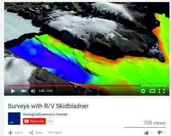
A short video has been produced showing the scientists at work onboard the R/V Skidbladner as they work up close to the edge of the glacier.
Youtube clip: https://youtu.be/r2NW8DyAONM
Working from the icebreaker Oden, the expedition focused on investigating marine cryospheric and oceanographic changes in the Petermann Glacier-Fjord and adjacent Nares Strait region that are accessible in geological records. This is to help understand the dynamics of the GIS.
The expedition involved collecting seismic data, multibeam mapping, coring and seismic reflection profiling in order to characterize the shape of the seafloor and uppermost sediment properties.
The Oden carried a smaller vessel, R/V Skidbladner, onboard for inshore work. The Skidbladner, a 6.4 m long aluminum boat, is equipped with a bow mounted high-resolution multibeam echo sounder and sub-bottom profiler. The Oden was able to map the seafloor in the centre of Petermann Fjord but not right up to the margins of the glacier - this where the Skidbladner comes in.
Information about the Petermann 2015 expedition at the Swedish Polar Research Secretariat and information about the people involved.
Petermann Glacier 2015 expedition information from the Department of Geological Science at the University of Stockholm.


