
3D images of the shape of the seafloor developed from the GEBCO_2021 Grid
Click on the images below to view and access world ocean bathymetry visualizations based on the GEBCO_2021 grid.


Bathymetry Globe (BathyGlobe)
Image:
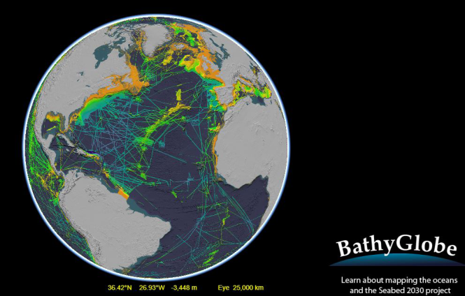
The BathyGlobe tool at the Center for Coastal and Ocean Mapping's (CCOM) web site shows those areas of the ocean that have been accurately mapped using the technology of multibeam echo-sounders.