• iho Logo
  • IOC of UNESCO Logo

Historical GEBCO charts

  • IHO Logo
  • IOC of UNESCO Logo

Archive of historical GEBCO charts now available online

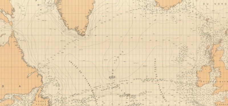
The GEBCO chart series was initiated in 1903 by Prince Albert I of Monaco - providing information on the shape and depth of the global seafloor.

Through the 20th Century, there were five paper editions of the charts series before GEBCO released its first digital products in the early 1990s.

The historical GEBCO paper chart series archive is now available to view online from the International Hydrographic Organization's web site.
 

Part of GEBCO Sheet A III (N) from the First Edition, published in 1904
 

Related Content

Similar news
Bathymetry of the Indian Ocean from the GEBCO grid
Mapping the global seafloor

Read an article in the UNESCO Courier (Apr-Jun 2017) by Vice Admiral (Rtd.) Shin Tani, Chairman GEBCO Guiding Committee, on why we need to map the seafloor.

Coverage of ships tracklines along which bathymetric depth measurements have been made in the Indian Ocean area west of Australia
Flight paths over the unmapped ocean

An assessment of ocean depth knowledge underneath commercial airline routes shows just how much of the seafloor remains unknown.