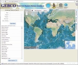
The GEBCO Sub-Committee on Undersea Feature Names (SCUFN) maintains and makes available a digital gazetteer of the names, generic feature type and geographic position of features on the sea floor.
The gazetteer is now available to view and download via a web map application in a number of formats including spreadsheet, shapefile, KML, WMS and ArcGIS layer and can be accessed as a REST-style API.
The web map application is hosted by the International Hydrographic Organization Data Centre for Digital Bathymetry (IHO DCDB) co-located with the US National Geophysical Data Center (NGDC).
The gazetteer contains information on over 3,600 seafloor features, for example, the Mid-Atlantic Ridge and the Challenger Deep — containing the greatest depth in the oceans, located in the Mariana Trench in the Northwest Pacific Ocean.


