Image:

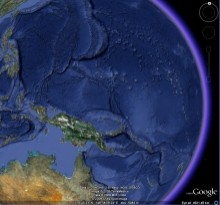
The GEBCO_08 Grid, GEBCO's recently released 30 arc-second global bathymetric grid, has been used in Google Earth 5.0 as a foundation layer for its global 3D model showing the shape of the seafloor.
The grid has been developed by combining quality-controlled ship-track soundings with interpolation between the soundings guided by satellite-derived gravity data.
Find out more about GEBCO's gridded bathymetric data sets and how to access the GEBCO_08 Grid.


