
The GEBCO grid is currently made available as a global 15 arc-second interval grid. However, in some regions, it is based on data at higher resolutions. To accommodate users who want access to higher resolution gridded bathymetry data, where it exists, a test multi-resolution grid product has been developed.
Currently, data at multiple resolutions is only available for certain test areas, i.e. off Australia, waters around New Zealand and the Hawaiian Islands.
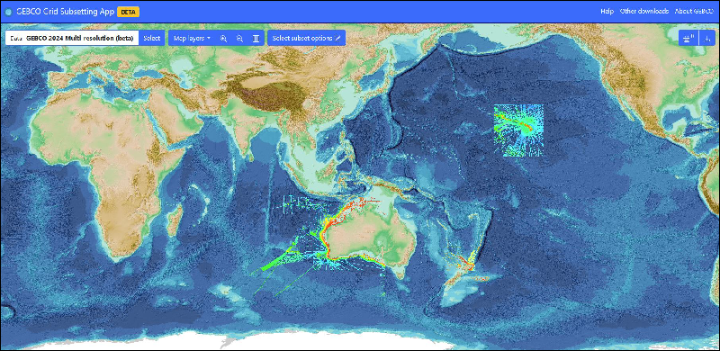
The ‘rainbow colours' show areas of multi-resolution data plotted on the 15 arc-second GEBCO grid (areas of blue shaded-relief).
Beta release download app
Try our beta release download app, https://betadownload.gebco.net, to access the available multi-resolution bathymetry data. Please provide feedback on the app to the Seabed 2030 Global Center ( gdacc@seabed2030.org ).
All GEBCO's grids are available to download via the app.
Specification for the multi-resolution grid product
- The higher-resolution grids are ‘sparse populated’ – i.e. only grid cells that are based on measured data are populated.
- Only contributed data that meets, or exceeds, the resolution goal for each depth range are integrated into the higher-resolution data products, as defined in Table 1. That is, data will not be over-sampled to provide higher resolution products.
- The grids are delivered in geographic co-ordinates.
The 15 arc-second interval grid will continue to be delivered as a global fully-populated grid, with areas not supported by direct measurement based on predicted bathymetry.
| Depth range (meters) | Grid resolution (degrees) | Approximate grid resolution (meters) |
| 0–1,500 | 0.001 | 100 |
| 0 – 3,000 | 0.002 | 200 |
| 0 – 11,000 | 0.004 | 400 |
Table 1. Depth range and grid resolution for the multi-resolution grids