
Introduction
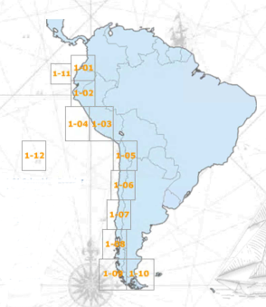
The International Bathymetric Chart of the South East Pacific (IBCSEP) is a regional ocean mapping project sponsored by the Intergovernmental Oceanographic Commission (IOC) of the United Nations Educational, Scientific and Cultural Organization (UNESCO). It is part of the seven regional components that elaborate International Bathymetric Charts (IBC), which aim to offer a good representation of the marine topography in scale of 1: 1 000 000, and a wide bathymetric knowledge, as well as about other aspects of world scientist interest.
The ocean floor bathymetric mapping is equivalent to the topographic mapping for the continental surface. Both of them provide base maps (or basic layers in Geographic Information Systems), for a wide variety of purposes including scientific investigation, modelling, exploration for natural resources, establishment of environmental policy and education.
As mentioned above, the IBCSEP is coordinated with the following ocean mapping regional projects:
- IBCAO: International Bathymetric Chart of the Arctic Ocean.
- IBCCA: Chart of the Caribbean Sea and the Gulf of Mexico.
- IBCEA: International Bathymetric Chart of the Central Eastern Atlantic.
- IBCM: International Bathymetric Chart of the Mediterranean.
- IBCWIO: International Bathymetric Chart of the Western Indian Ocean.
Specifications
Access specifications for the project.
Editorial Board
Access information about the IBCSEP Editorial Board
Products
Information about the products from IBCSEP.
Meetings
Access information about IBCSEP meetings